
 Image 1 of 5
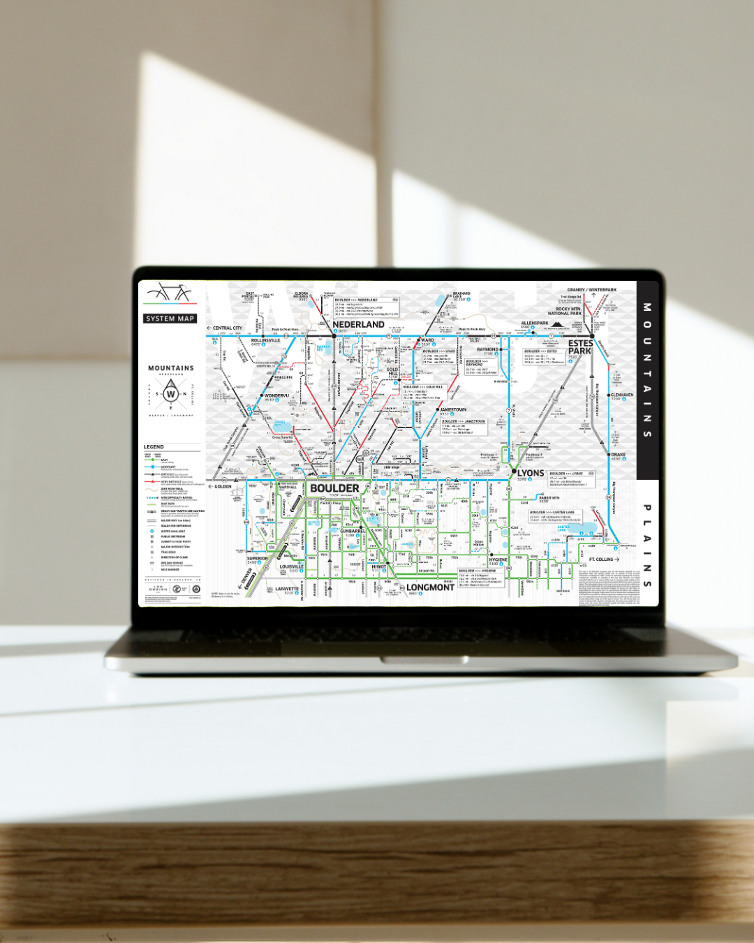 Image 2 of 5
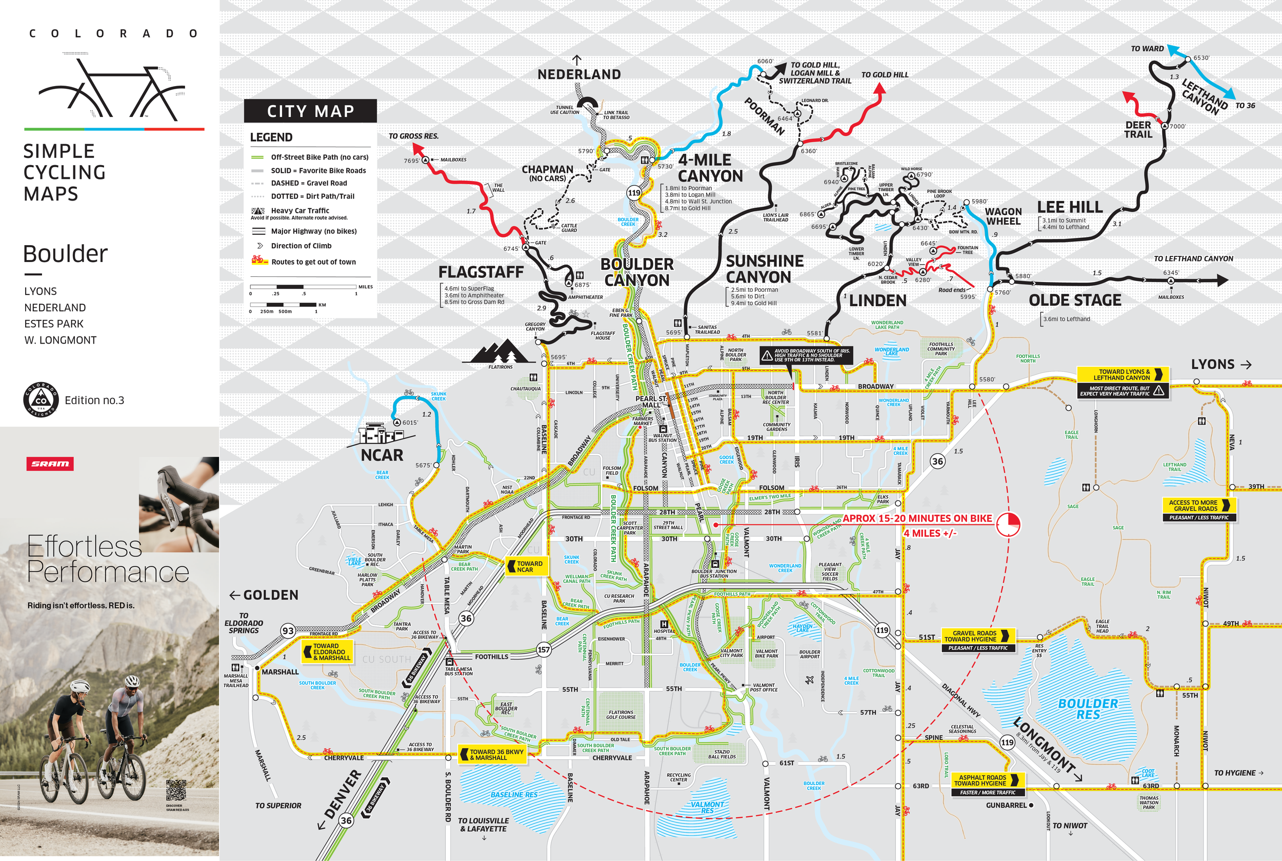 Image 3 of 5
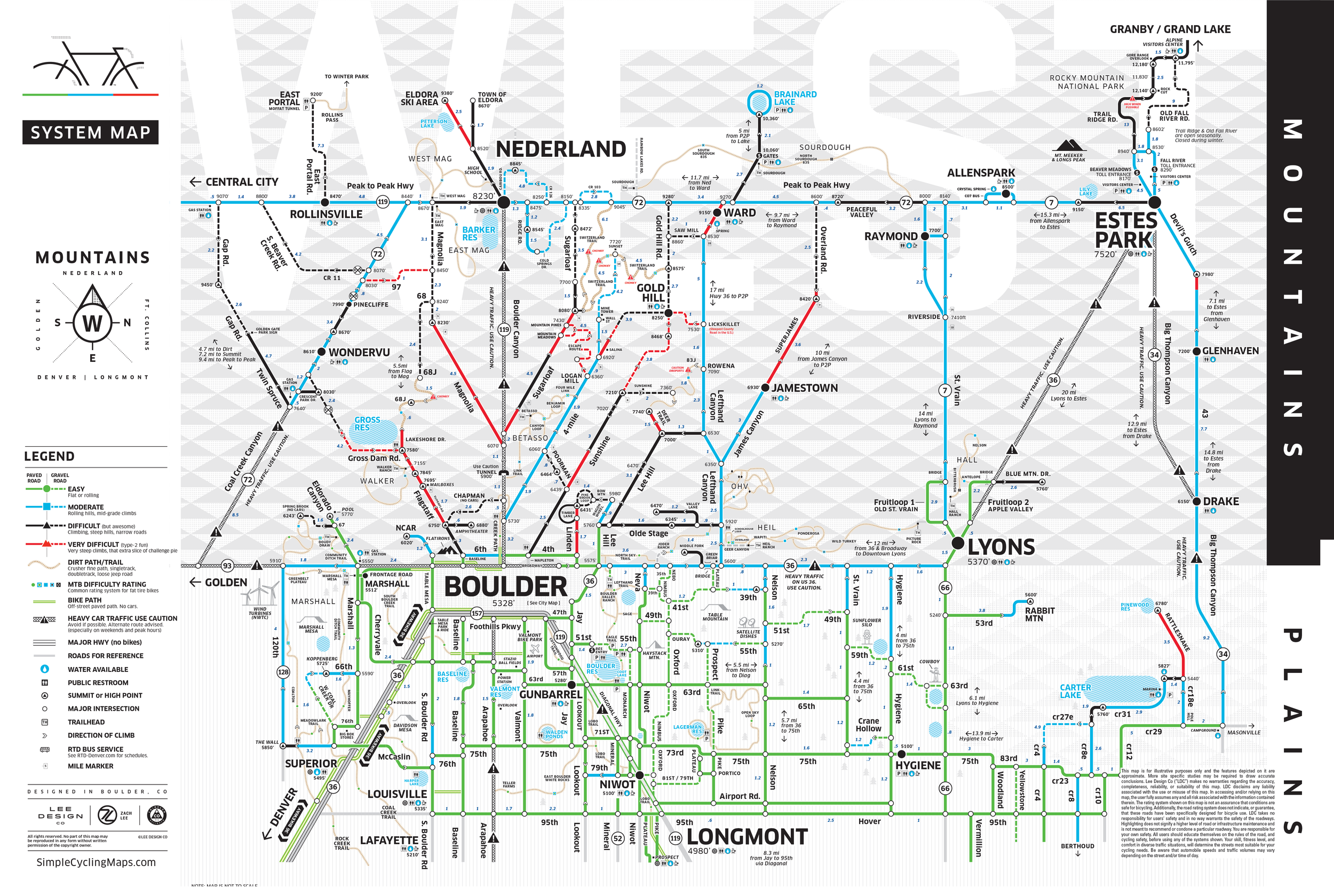 Image 4 of 5
 Image 5 of 5
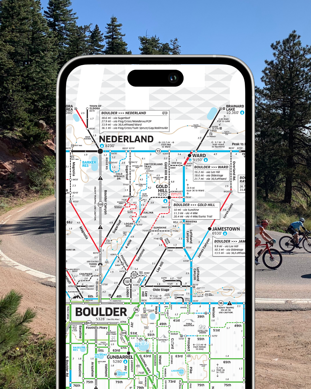
The Boulder System Map, now in your pocket — digitally.
All the info you need on your phone and nothing more.
Includes both the city map and system map
Zoom in and out on trail, no cell service needed
Color-coded for average level of difficulty
West-up orientation toward the mountains
Oversimplified diagram of road network
Major cyclist destinations, water stops, mileage & elevation
Mountain bike trails included
Designed in Colorado, supported by SRAM
Downloads as a PDF — opens in Adobe Acrobat or your phone's Files app. Zoom in freely, no cell service needed.

