
Our Work
Trail maps, community cycling maps, wayfinding signage, and environmental design for the organizations and places that move people outdoors.

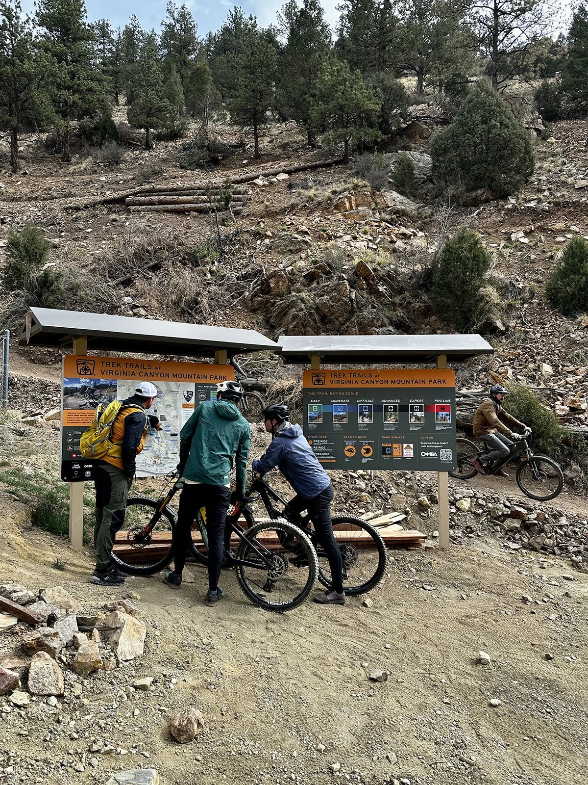
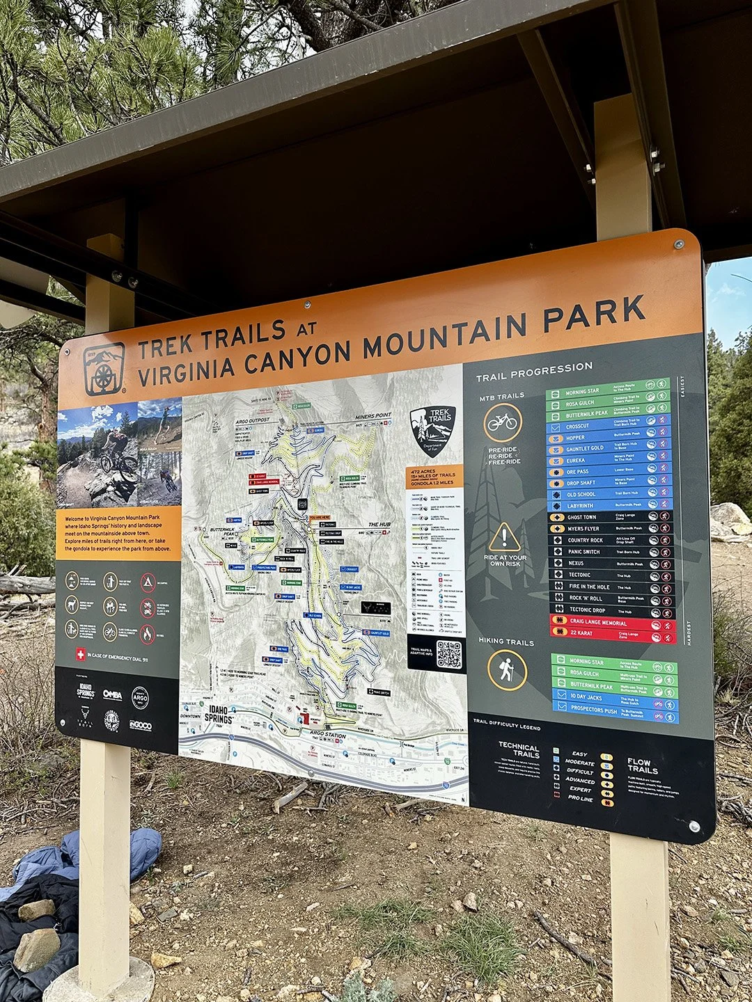
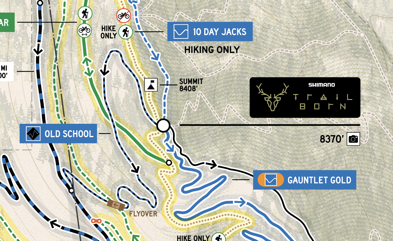
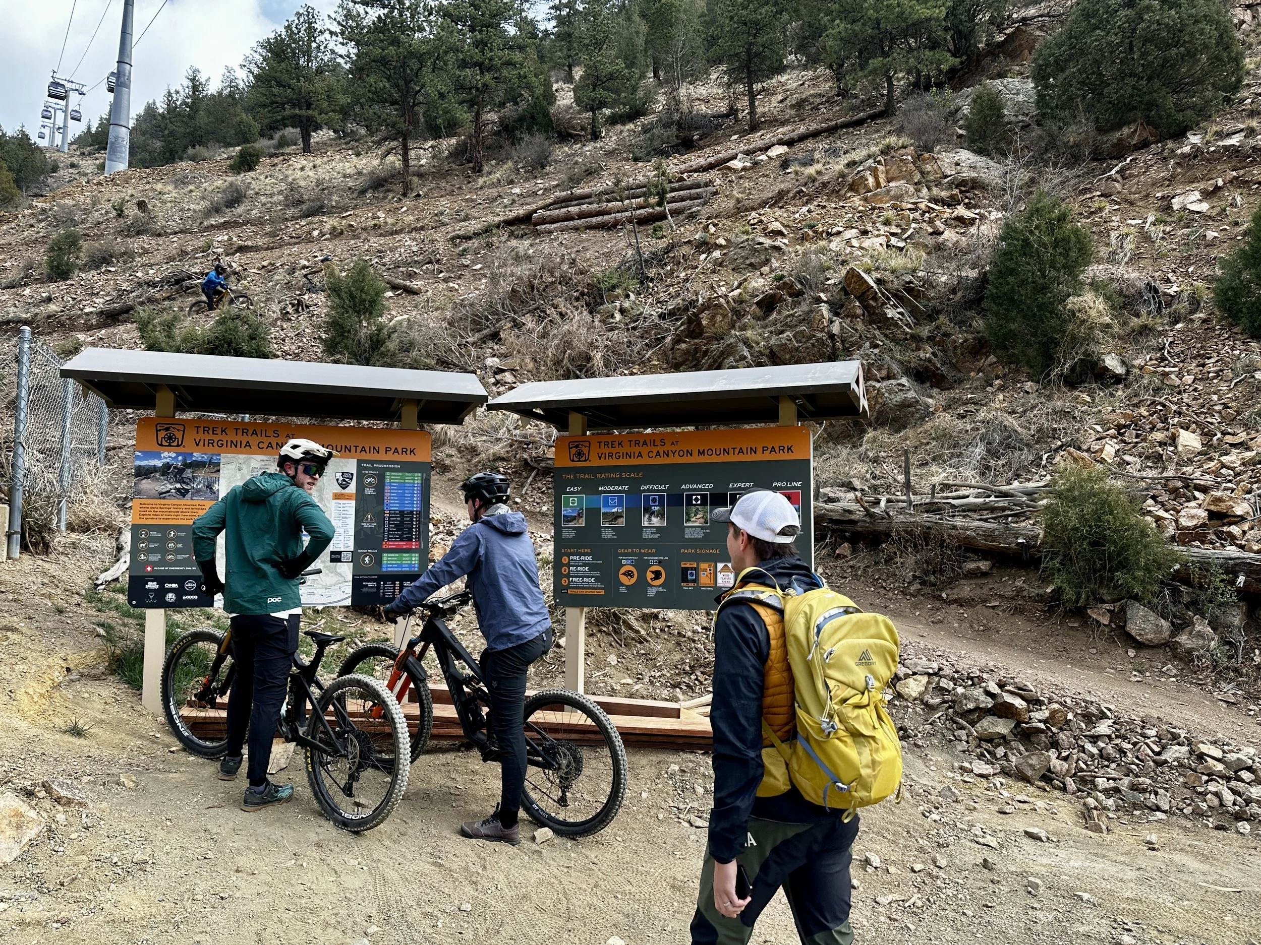
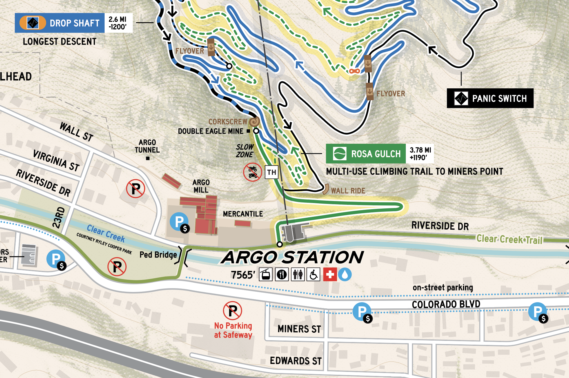
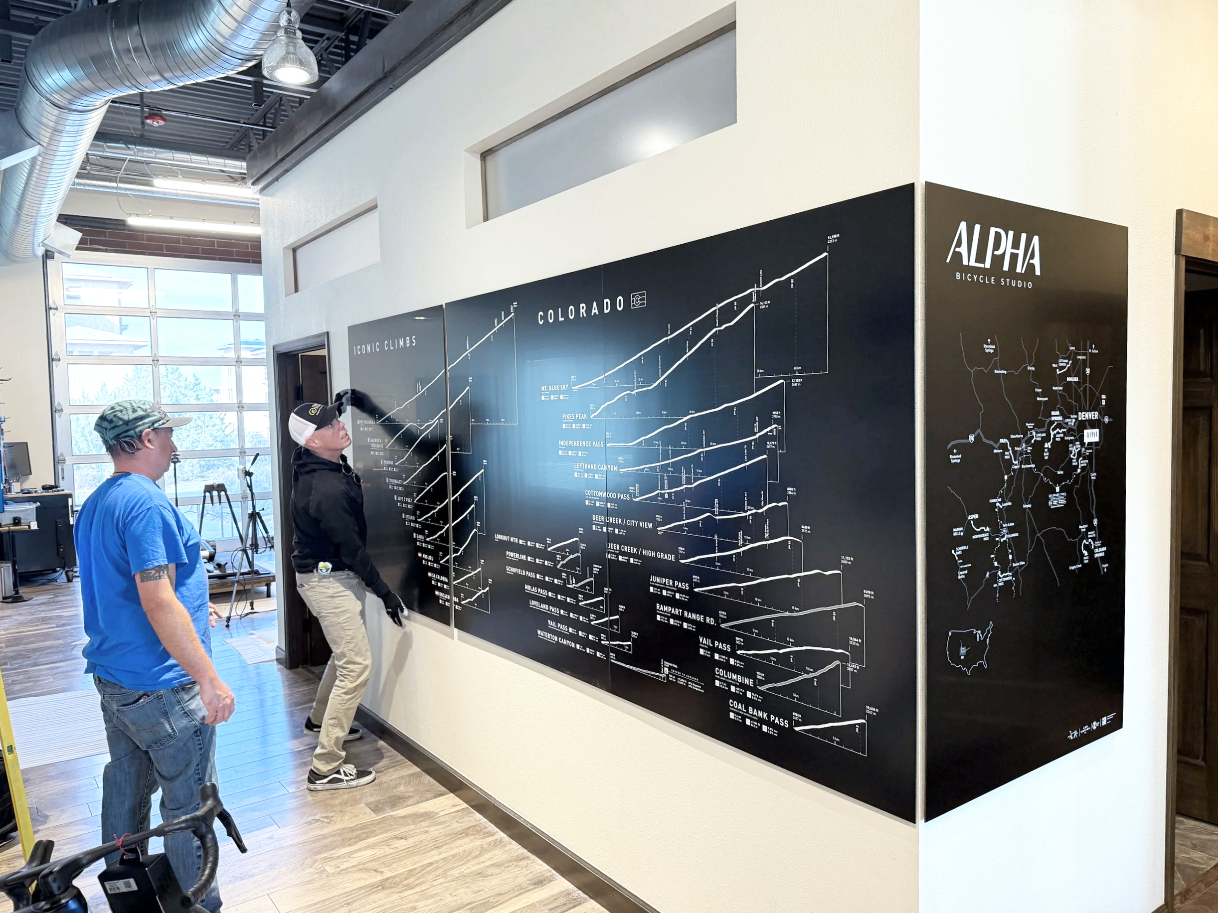
Virginia Canyon Mountain Park — Trail Map & Trailhead Installation
"Zach and Michelle did an incredible job capturing the complexity of this condensed trail system and turning it into an easy-to-understand, visually striking piece of artwork. We're thrilled with how it turned out and can't thank them enough for their time and dedication to this project."
— COMBA, Colorado Mountain Bike Association
Virginia Canyon is a dense, technically varied trail system — the kind that intimidates new riders and frustrates experienced ones who can't see the full picture at once. COMBA needed a map that could handle that complexity: clear enough to build confidence in beginners, detailed enough to be genuinely useful for regulars, and installation-ready for the trailhead from day one.
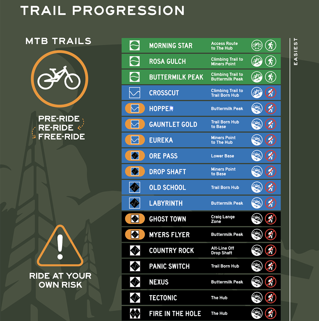
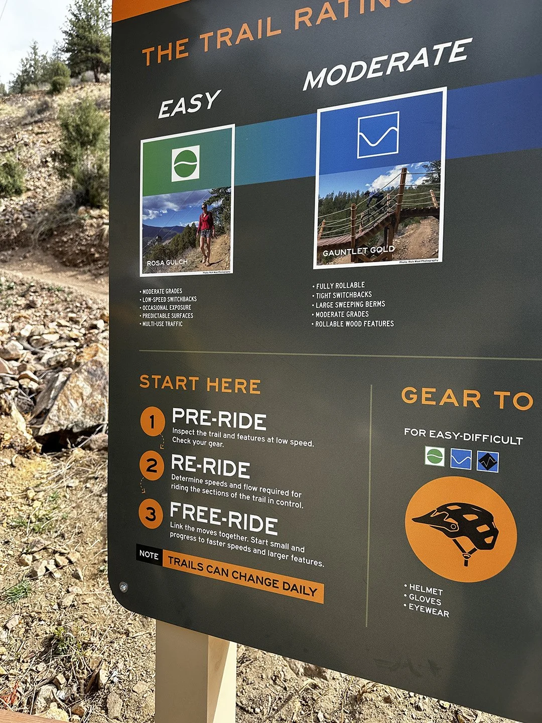
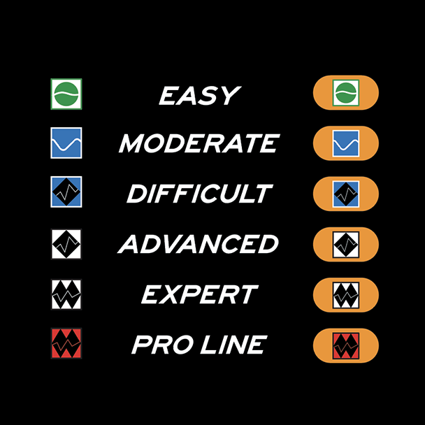
We designed a print-ready infographic-style trail map that organizes the system visually — using a trail progression key from Easy to Advanced, callouts for technical features and freeride elements, and an integrated rules and guidelines panel. Every format was covered: print-ready PDF and AI files, a web-optimized digital version, and a trailhead-scaled installation layout. We also delivered all layered source files so COMBA can update the map themselves as the trail system evolves.
✓ Infographic-style trail map (PDF, AI, PNG)
✓ Trail progression key — Easy → Advanced
✓ Technical feature and freeride callouts
✓ Rules & Guidelines panel integrated into design
✓ Web-optimized digital version
✓ Trailhead installation-ready layout
✓ All layered source files (Adobe Illustrator)
✓ Printing coordination and vendor-ready files
Client
COMBA — Colorado Mountain Bike Association
Completed
04/25/2026
-
![]()
Map Detail
-
![]()
Progression Chart
-
![]()
Sign Close-up
-
![]()
Trail Difficulty Legend
-
![Trailhead Sign]()
Trailhead Sign
-
![]()
Map Detail
-
![Trailhead Signs]()
Trailhead Signs
-
![]()
Map Detail

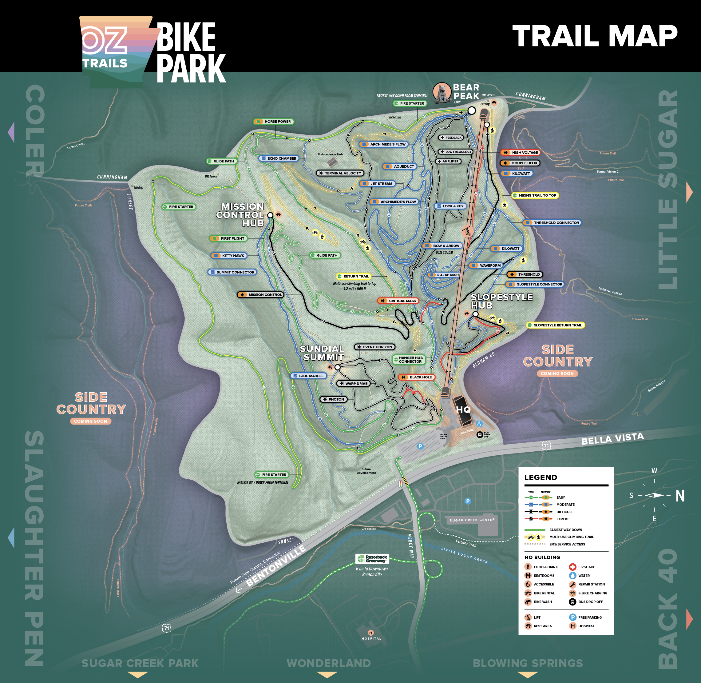
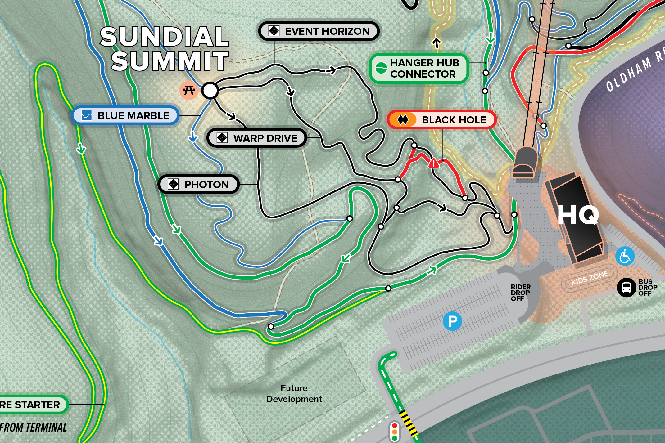
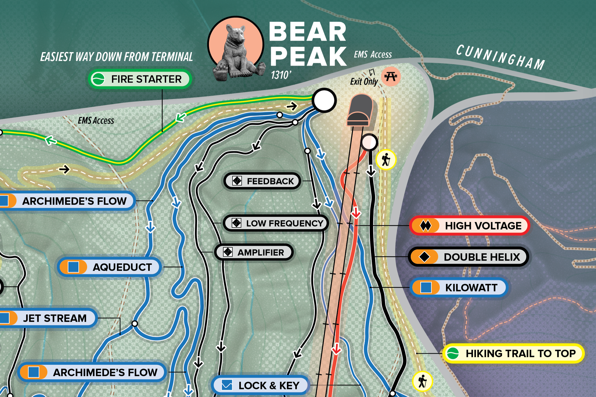
OZ Trails Bike Park — Master Trail Map
Full case study coming 2026. Building a destination bike park and need a map to match? We'd love to hear about your project.
OZ Trails Bike Park is a destination-scale park in Bentonville, Arkansas — a complex, downhill-focused trail system built for everyone from first-time families to expert riders chasing Expert-rated descents. Runway Group needed a master map that could hold all of that complexity without losing clarity, and that worked equally well as a 5'×10' backlit wall installation, a digital web asset, and a navigational tool for riders standing at a trailhead.
We're designing a park-wide master map built around descent-forward navigation — prioritizing how riders move from the top down, through three distinct hubs: Bear Peak, Mission Control, and the Slopestyle Hub. The map integrates a full trail progression system from Easy to Expert, shared-use considerations for hikers and e-bikes, feature callouts for technical and freeride elements, and a rules and guidelines panel. The visual framework is designed to accommodate future trail additions — Side Country expansions are already noted — so the map stays current as the park grows.
Client
Runway Group — OZ Trails Bike Park, Bentonville AR
Projected Completion
05/01/2026
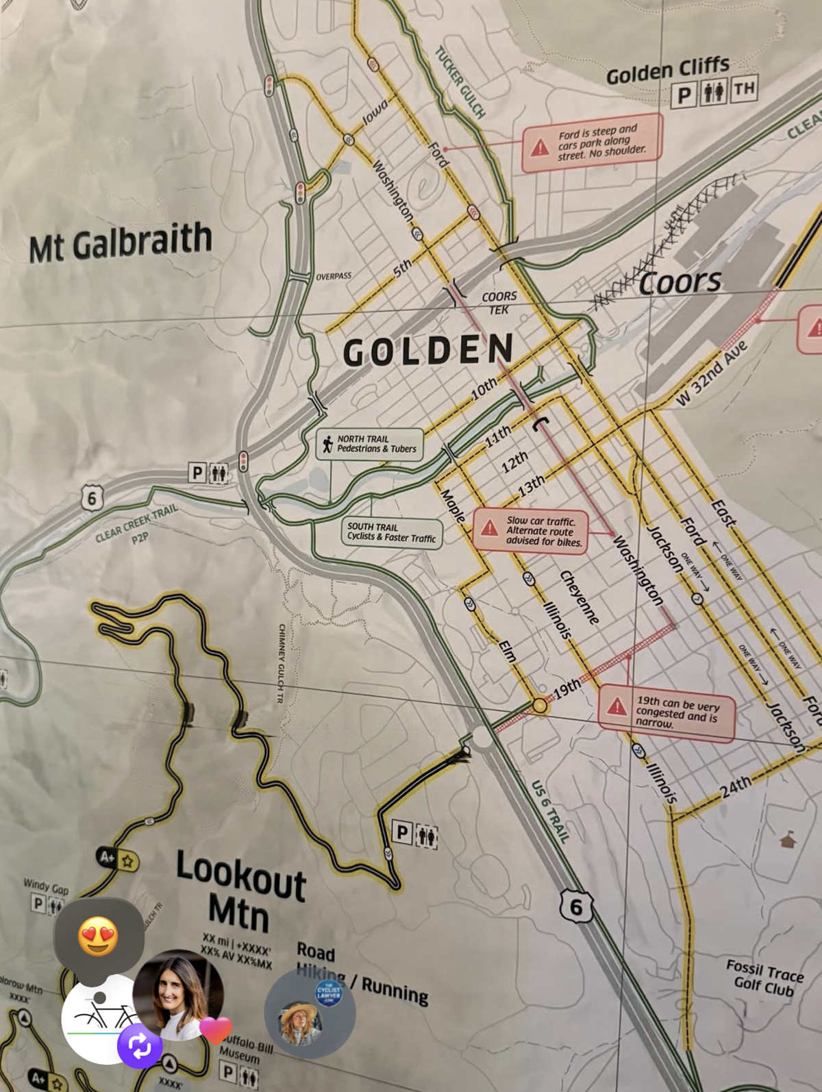
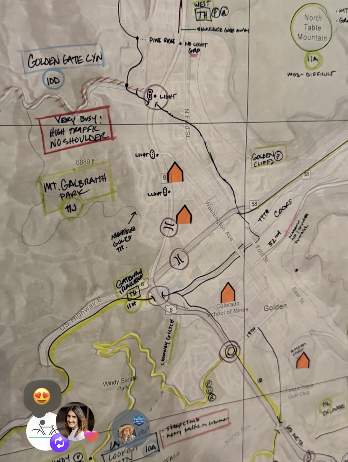
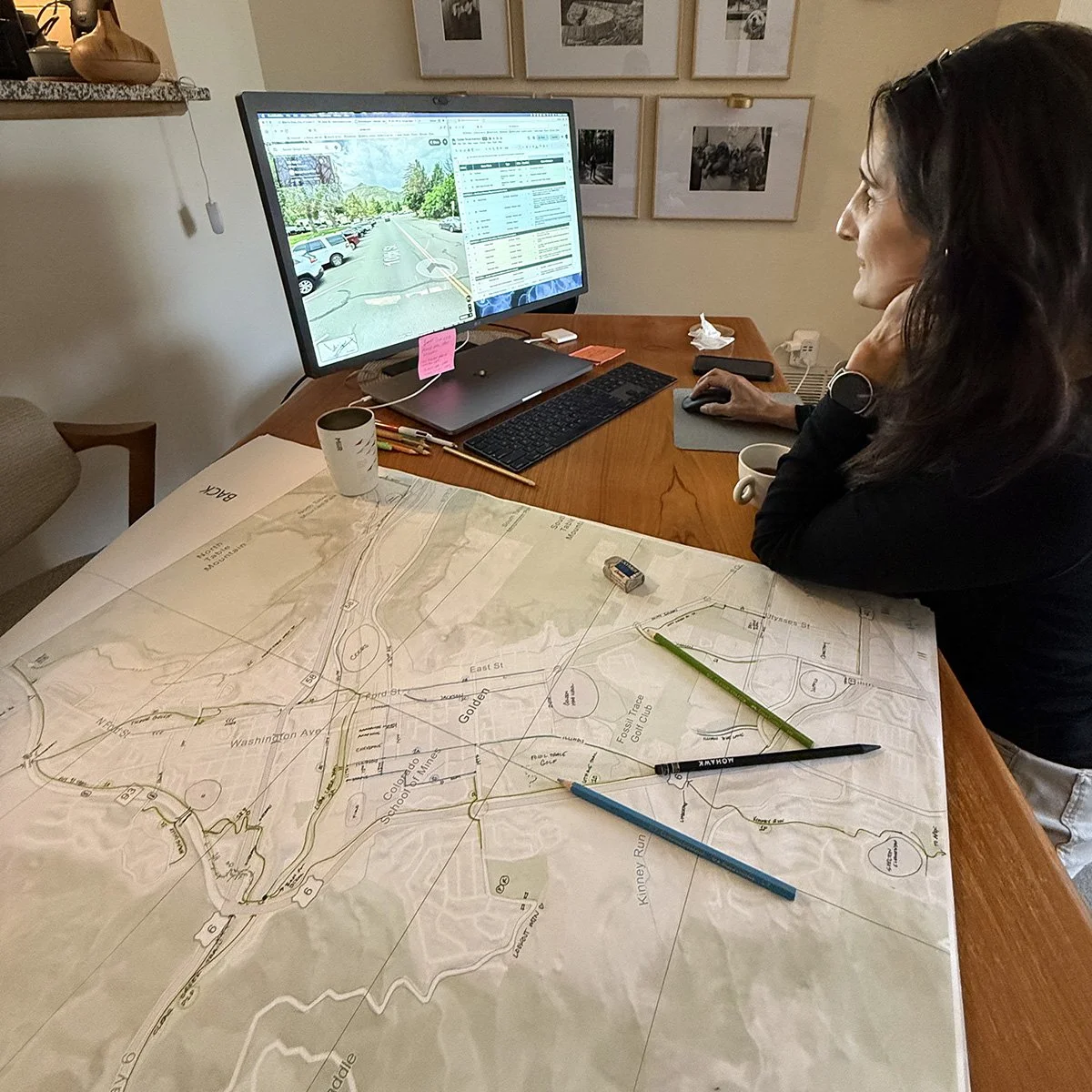
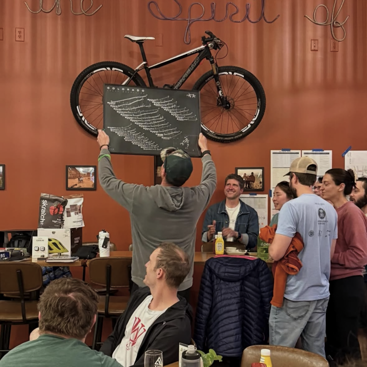
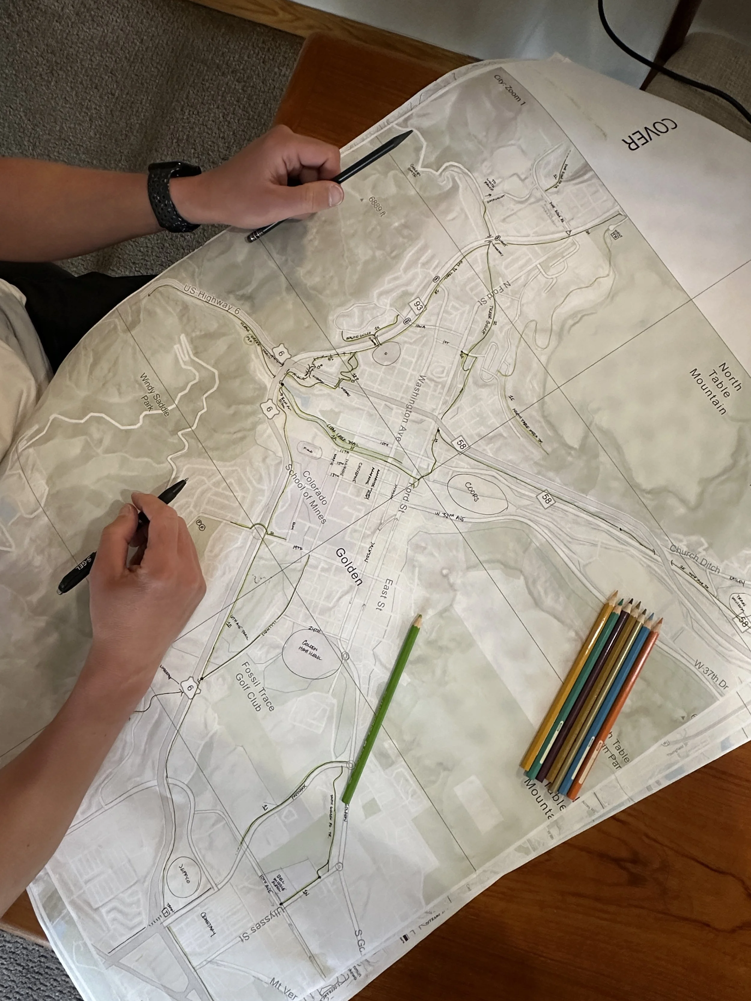
Bike Walk Golden —
Multi-Format Community Cycling Map
Full case study coming in summer 2026. Interested in a similar project for your organization? We'd love to hear from you.
Currently in progress
Bike Walk Golden came to us with a clear goal: create a cycling map that serves everyone who rides in Golden — the local commuter, the tourist on a day trip, the road cyclist visiting from out of town, and the resident who wants it framed on their wall. That's a wide audience, and it requires a map that works across multiple formats simultaneously. We're currently designing a full system: a pocket-sized folded map for on-the-go riders, a large-format poster for community centers and bike shops, a digital version optimized for web and mobile, and signage-ready artwork adaptable to kiosks and trailheads.
✓ Pocket-sized folded map (on-the-go riders)
✓ Large-format poster (bike shops, community centers)
✓ Digital version (web and mobile optimized)
✓ Co-branded versions for sponsors
Client
Bike Walk Golden
Projected Completion
summer 2026
-
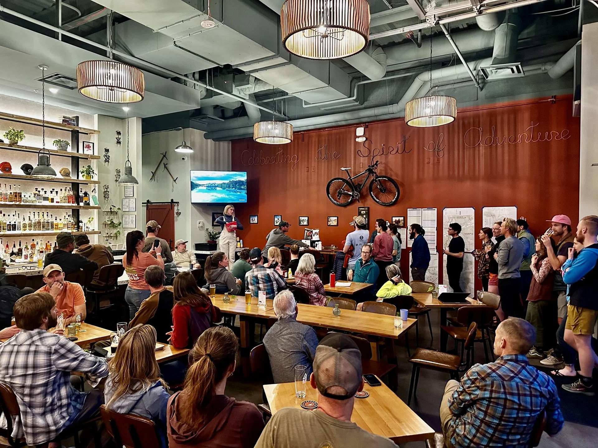
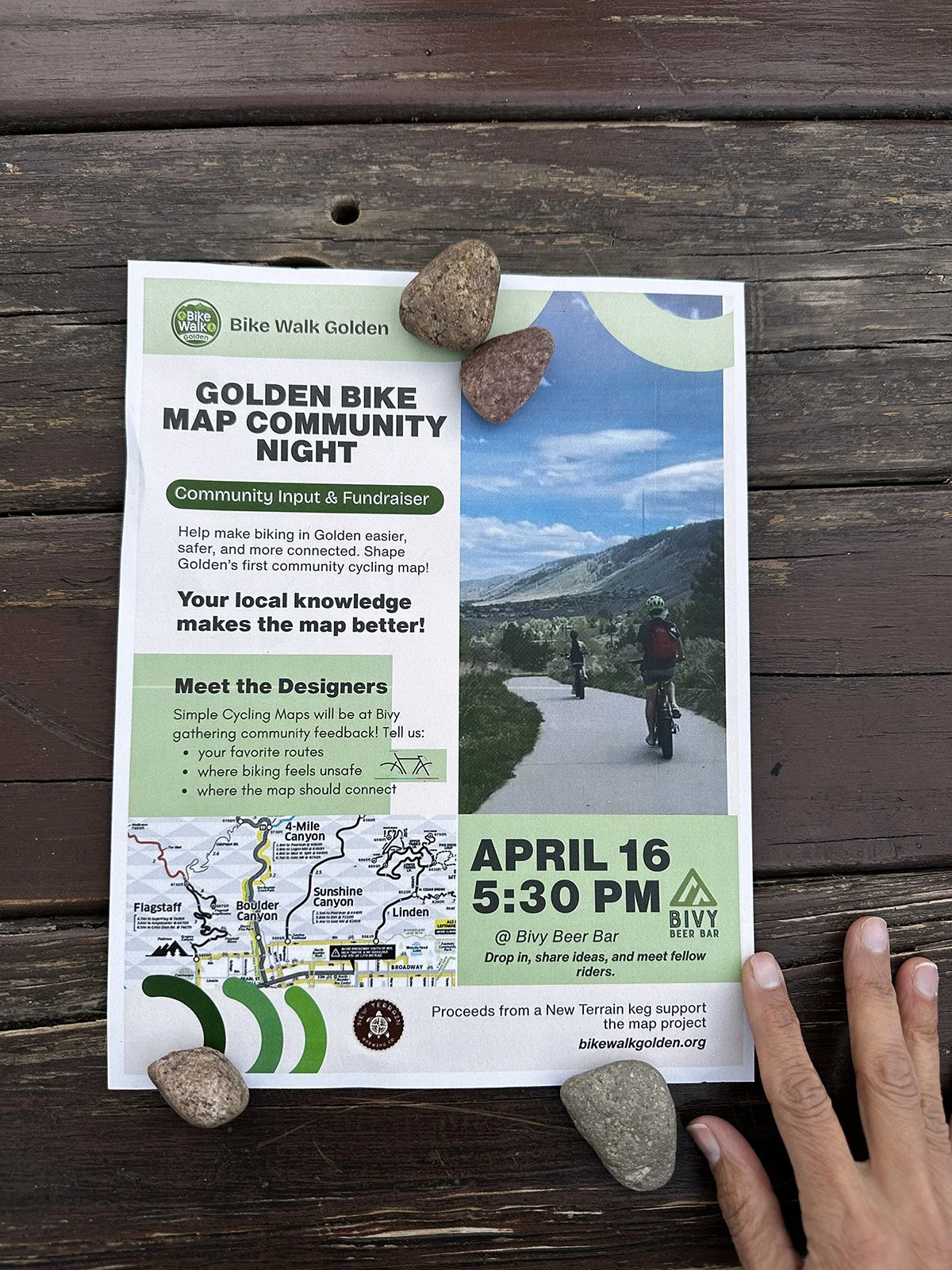
![]()
Community Event
-
![]()
Community Event
-
![]()
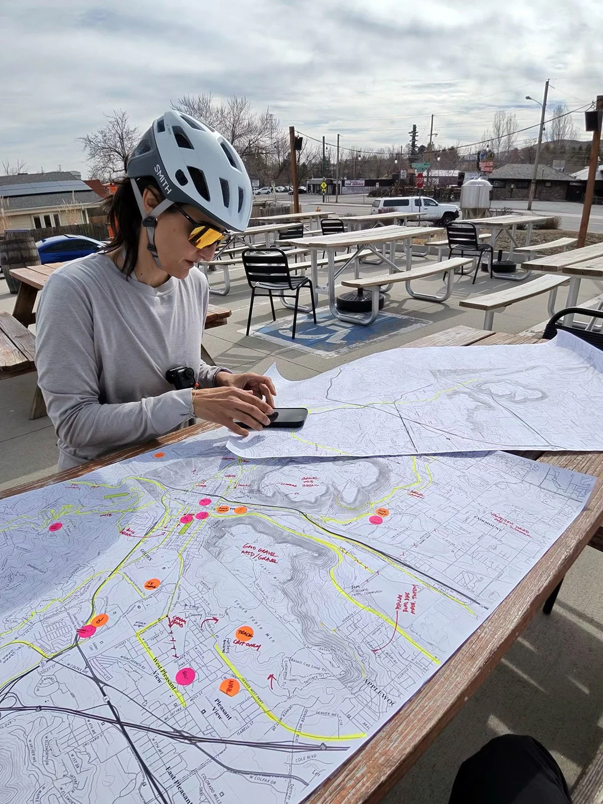
Research & Validating
-
![]()
Map Draft Research
-
![Map Progress Notes]()
Map Progress Notes
-
![Research and Synthesis]()
Research & Synthesis
-
![Fundraising Auction]()
Fundraising Auction
-
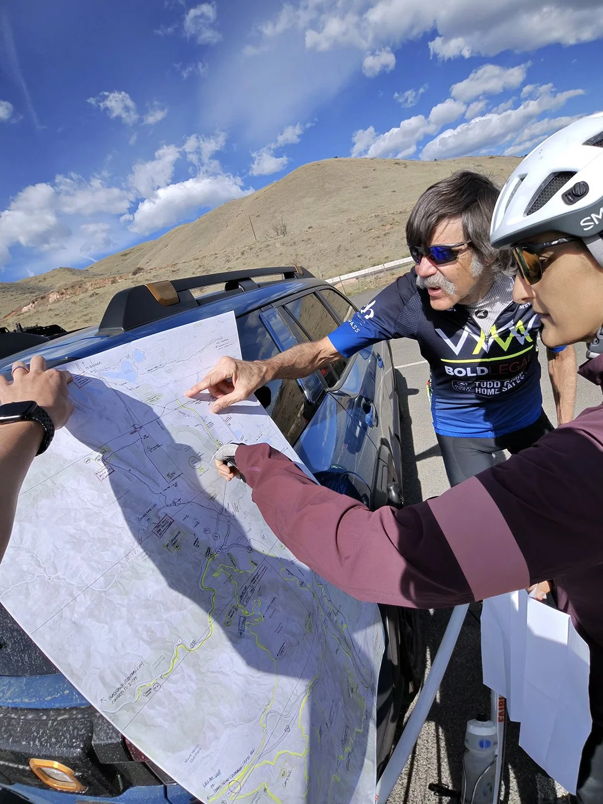
![Markups]()
Markups
Selected Projects


Client List - Selected
-
Rapha
Specialized Bicycle Components
Skratch Labs
Donnelly Cycling
Point6 -
Parc Mosaic
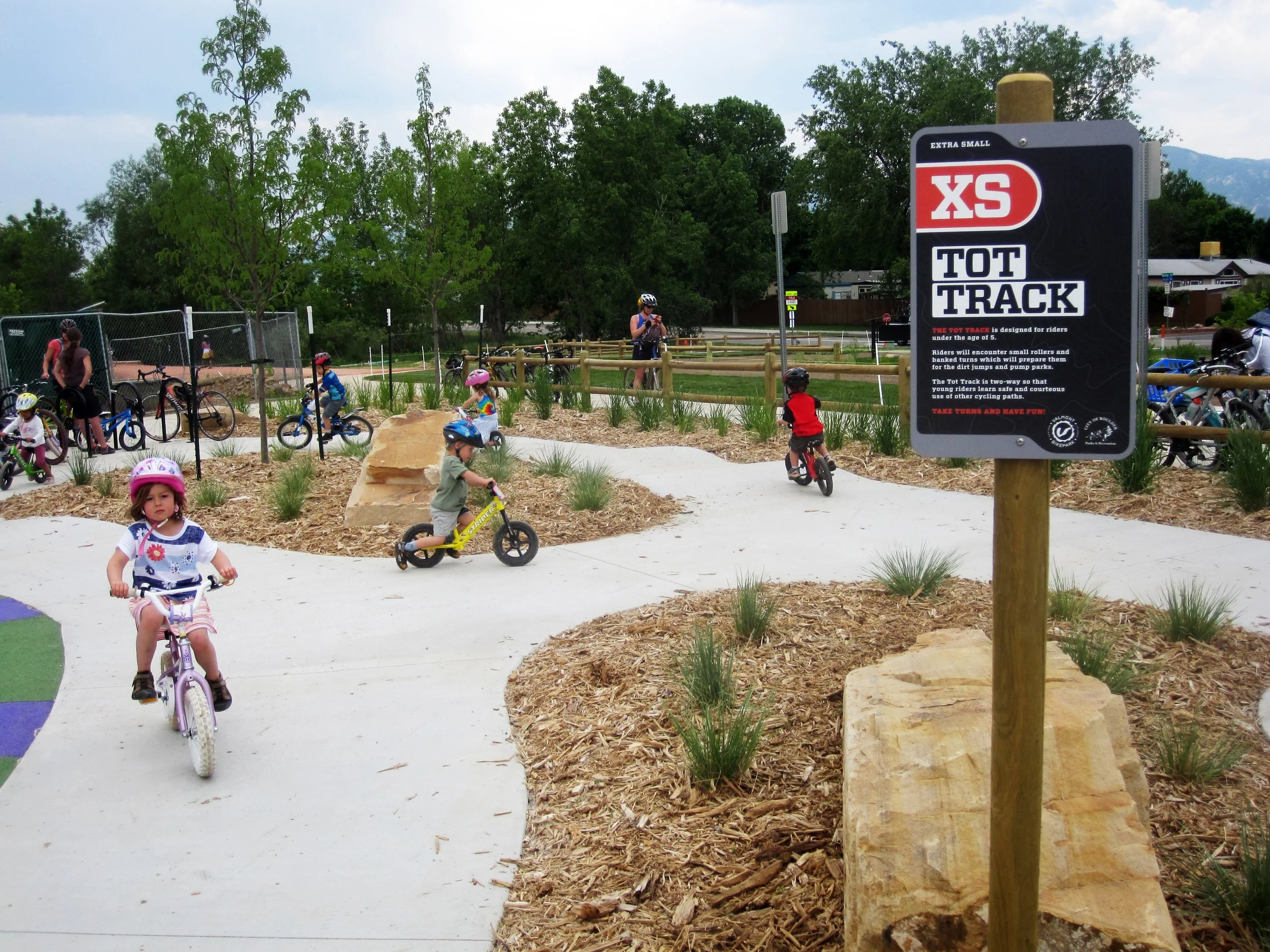
Valmont Bike Park
Weathervane
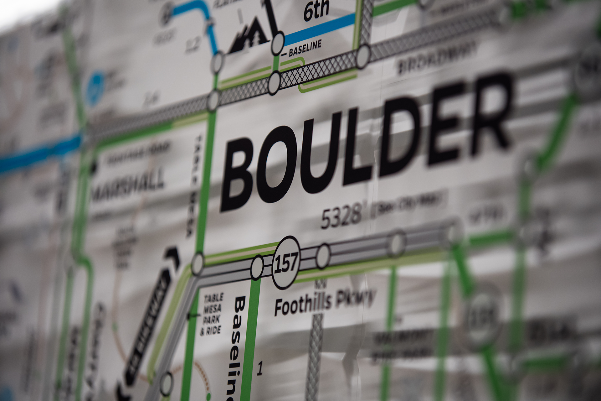
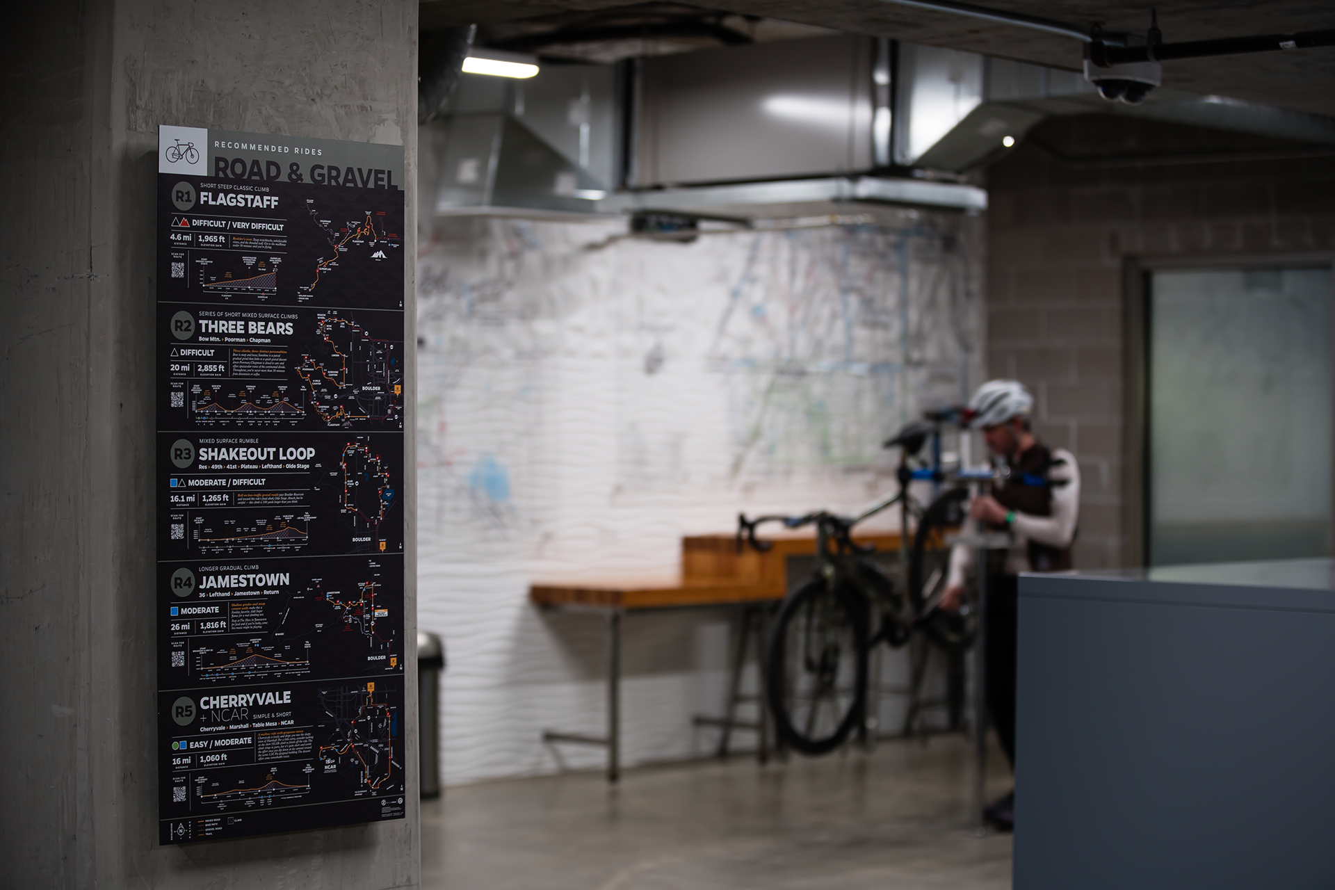
City of Boulder
Value Retail (Europe) -
Rapha
Full Cycle
Mosaic Cycles
Cassiopeia
Cross Vegas
Boulder Roubaix
Cyclocross Nationals
FayetteCross
About the Studio
Credentials
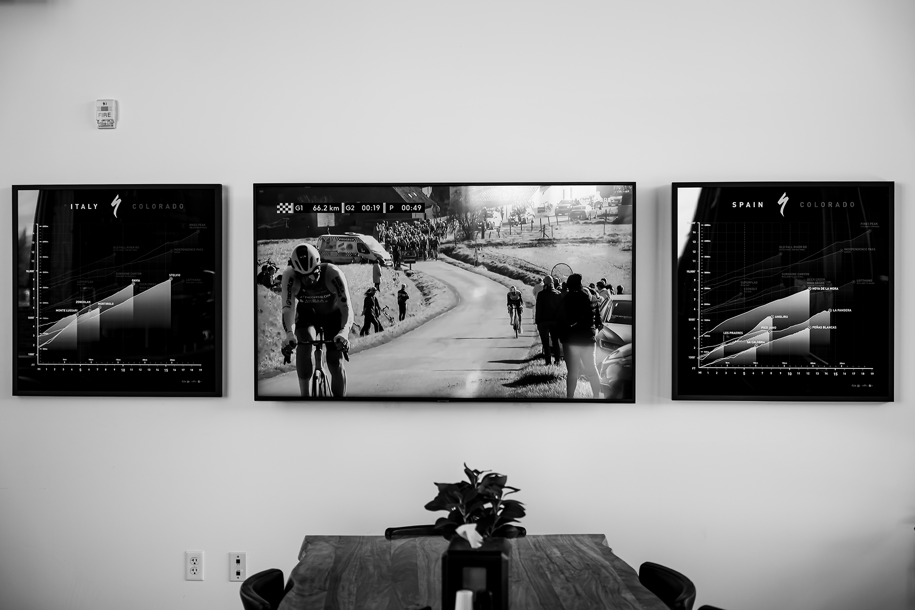
Lee Design Co brings together 20+ years of experience in environmental graphics, branding, and large-scale installations — with deep roots in cycling and outdoor culture. Zach has designed brand experiences for Specialized Bicycle Components, Rapha, Skratch Labs, and Donnelly Cycling. Michelle's background in architecture, urban design, and business operations means every project is both visually striking and practically sound.
Point of View
We're based in Boulder, Colorado — one of the most active cycling communities in the country — and we ride what we design. That matters when you're building a trail map that has to work for a nervous first-timer and a local expert at the same time, or a signage system that riders will rely on at speed.
Process Promise
Every project starts with understanding your trail system, your community, and your riders. We deliver all the formats you need — from trailhead installation files to web-ready digital versions — and we hand over source files so you're never locked out of your own work.

📷: @raphaboulder
Start a Project
Tell us about your trail system, your community, and what you need — and we'll come prepared for a real conversation.