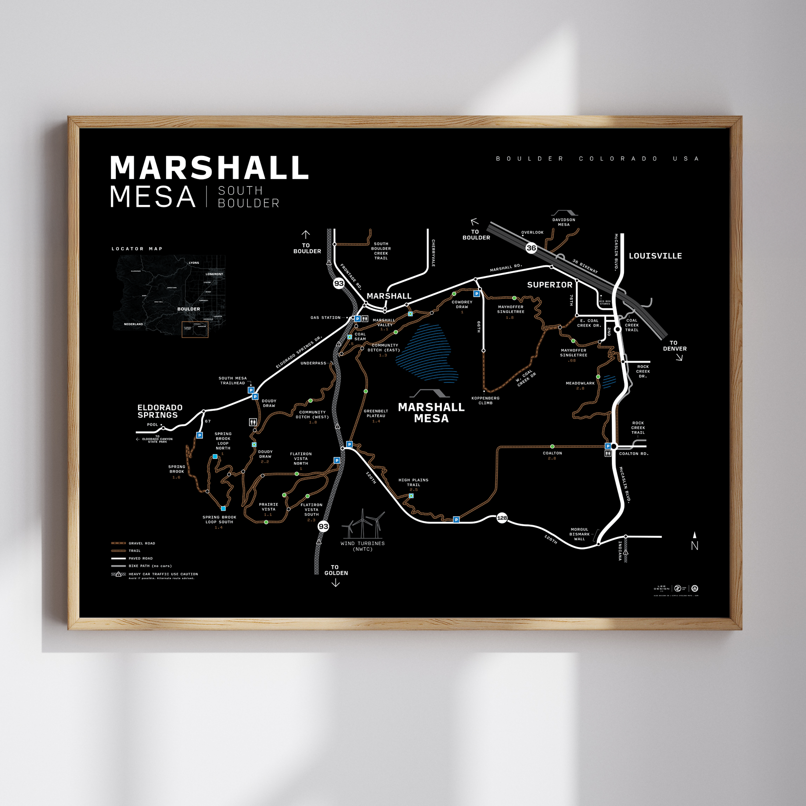
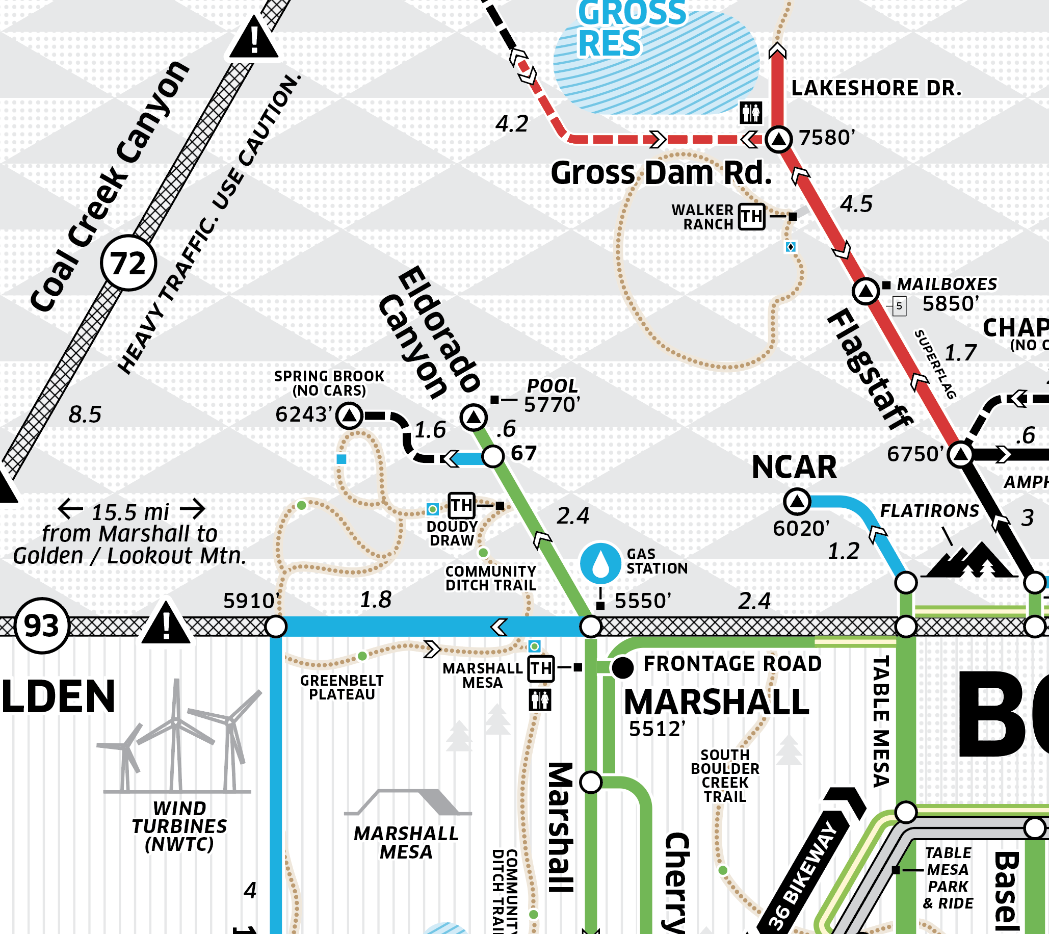
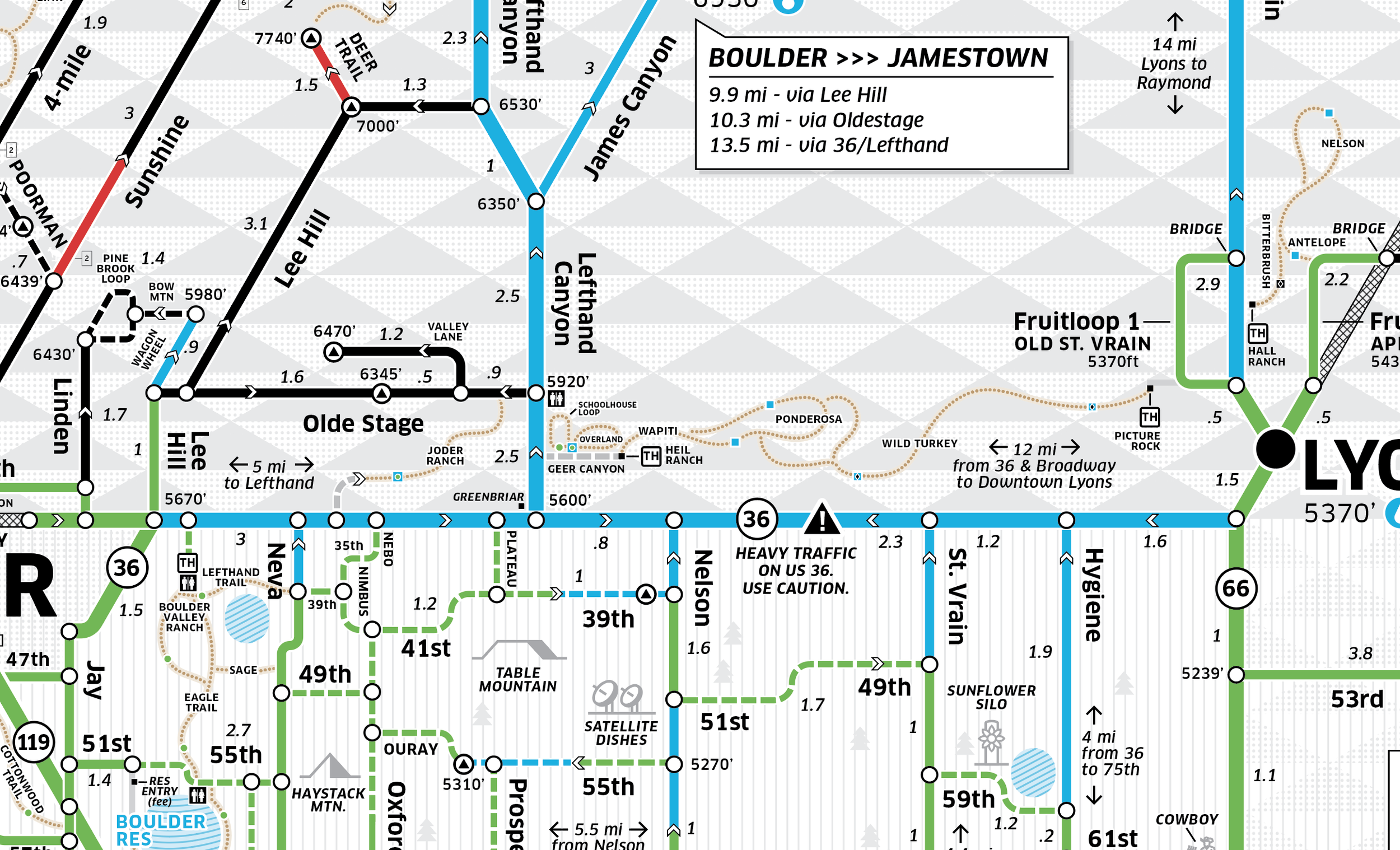
This 18x24" print captures the sun-soaked magic of South Boulder’s most beloved trails. The Marshall Mesa map highlights a network of scenic routes that weave through open grasslands, wind past mesas, and climb into the foothills—perfect for casual spins or full-on weekend rides.
Explore local favorites like Cowdrey Draw, Community Ditch, and Mayhoffer Singletree, or string together a bigger loop with Spring Brook, Doudy Draw, and Flatirons Vista trails. With connections to Eldorado Springs, Superior, and Louisville, this area makes it easy to ride from town into nature and back again.
Designed with clean lines, thoughtful labeling, and cyclist-specific insights, this map is both a functional tool and a beautiful keepsake for Boulder locals and trail lovers alike.
Main Junction/Intersection Points
Road Surface Indicated (Solid = Paved, Dotted = Gravel)
Distance
Elevation
English & Metric
18x24 size
If you’re interested in a custom size or special format, please reach out. We can accommodate any request.