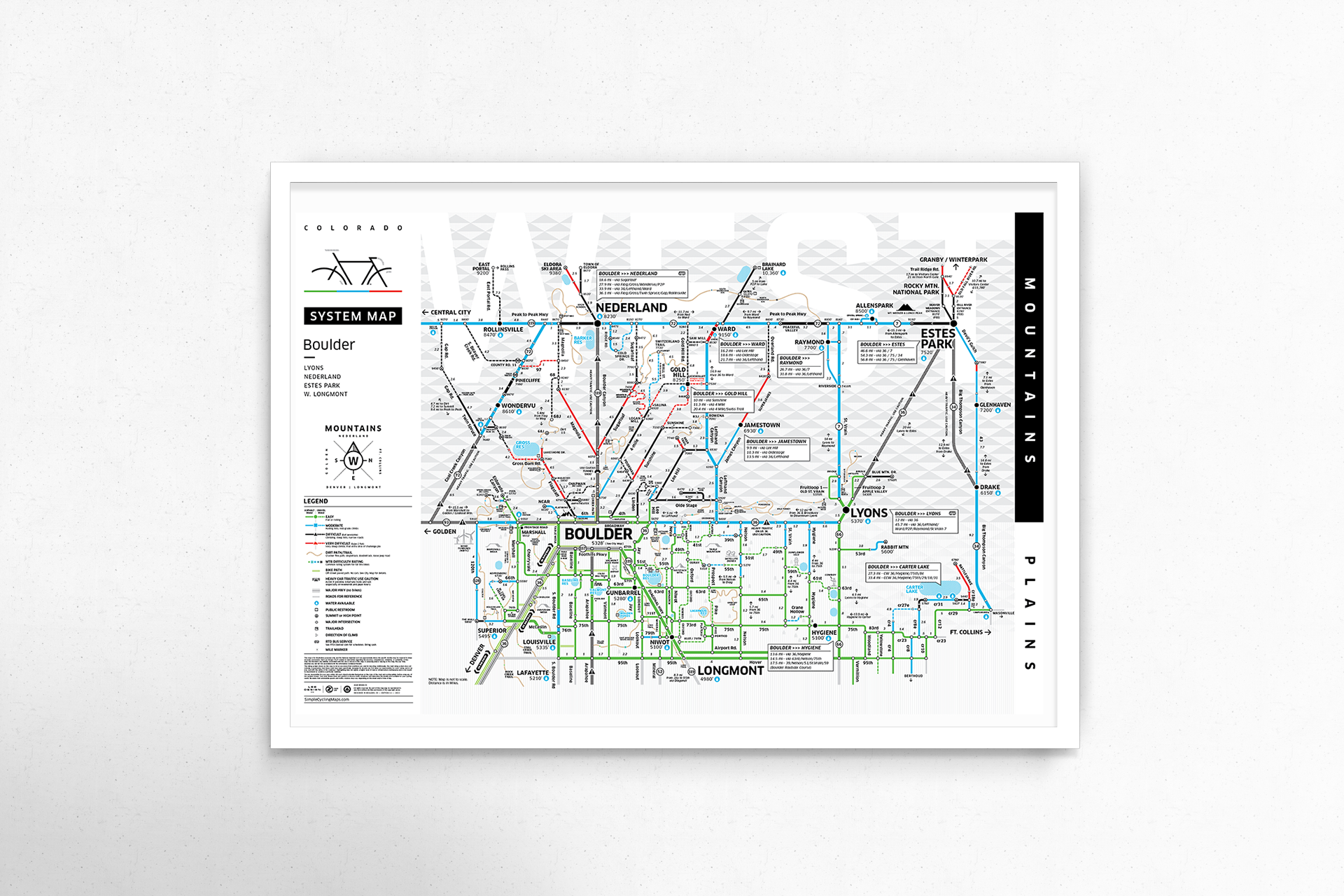
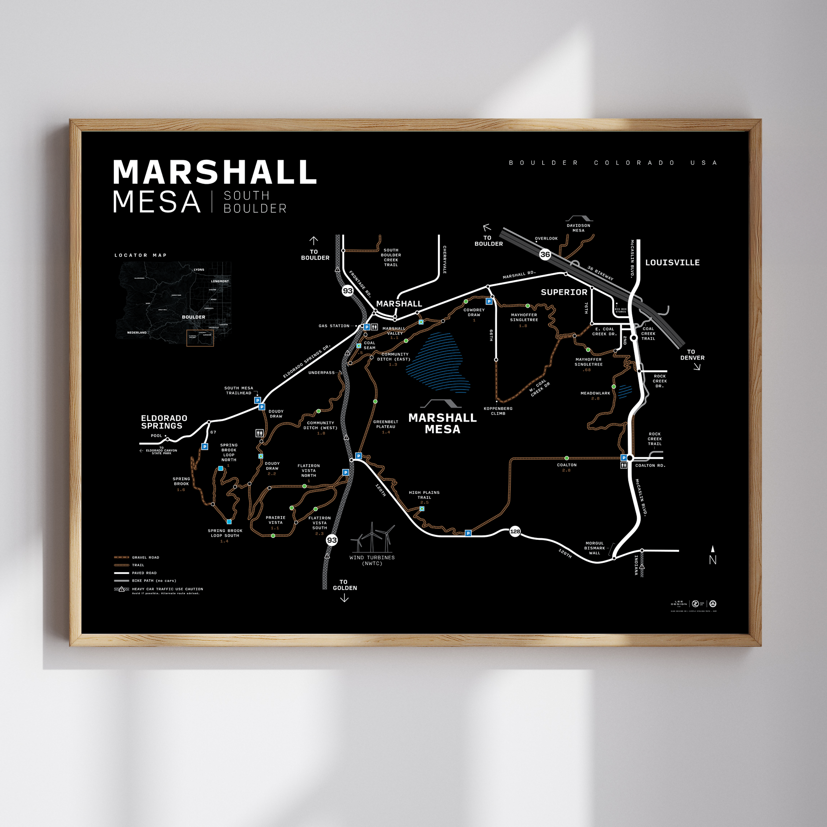
All the info you need as a cyclist and nothing more.
Think of a subway map + ski resort.
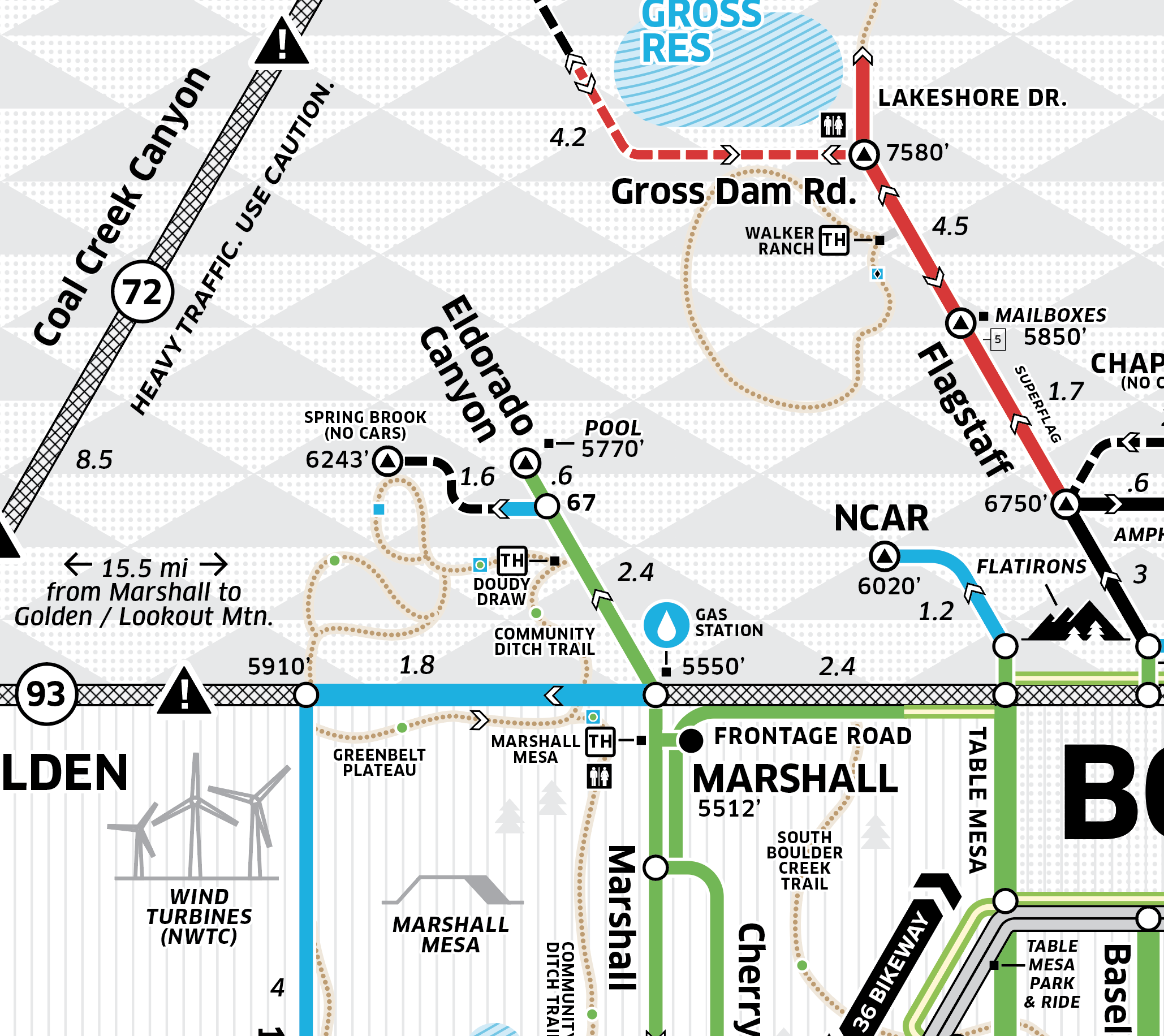
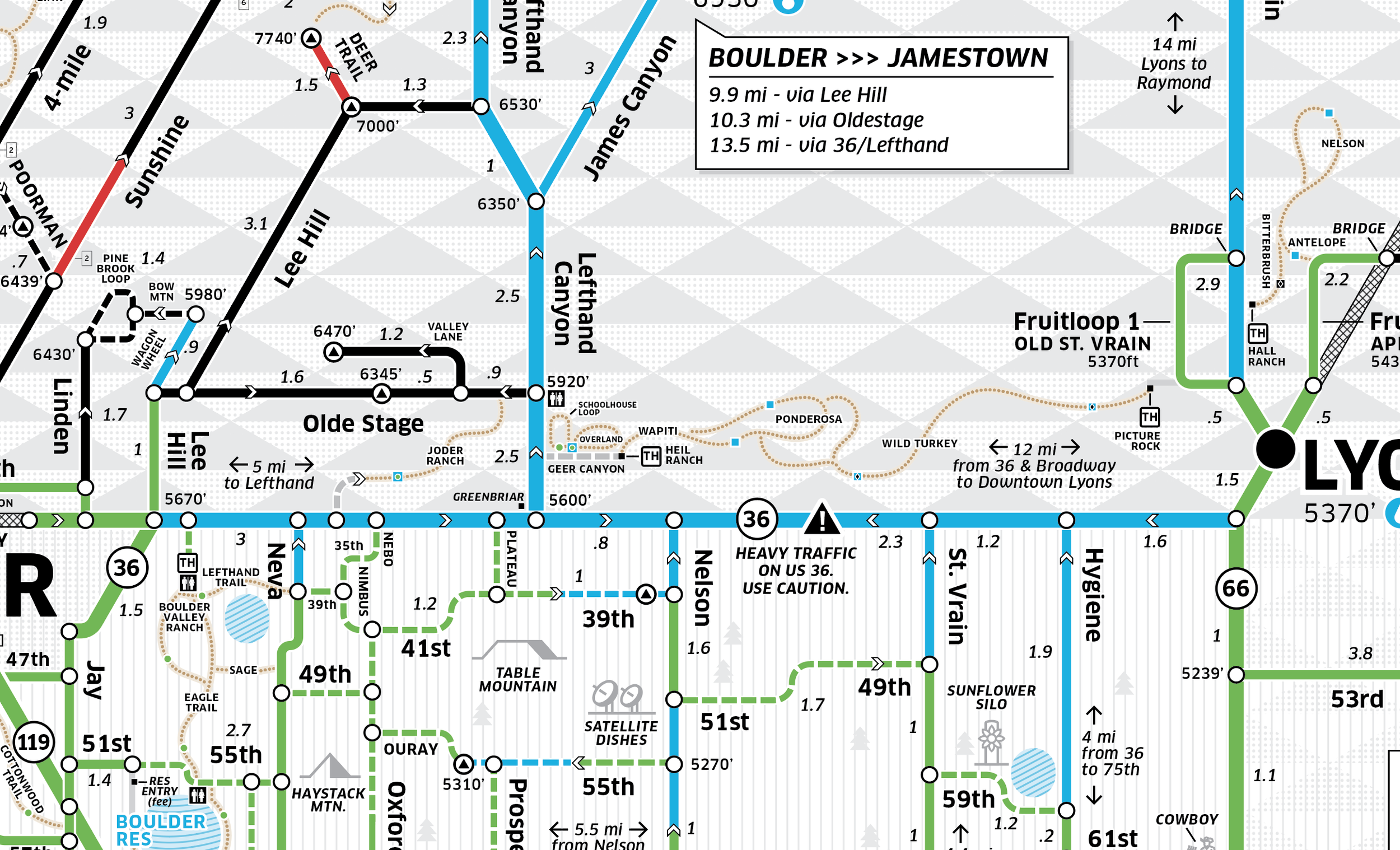
West-Up orientation toward the mountains
Color-coded for average level of difficulty
Oversimplified diagram of road network
Indicates major cyclist destinations in the area
Water stops
Mileage & elevation
NEW: Mountain bike trails added
Designed & printed in Colorado
All the info you need as a cyclist and nothing more.
Think of a subway map + ski resort.
West-Up orientation toward the mountains
Color-coded for average level of difficulty
Oversimplified diagram of road network
Indicates major cyclist destinations in the area
Water stops
Mileage & elevation
NEW: Mountain bike trails added
Designed & printed in Colorado