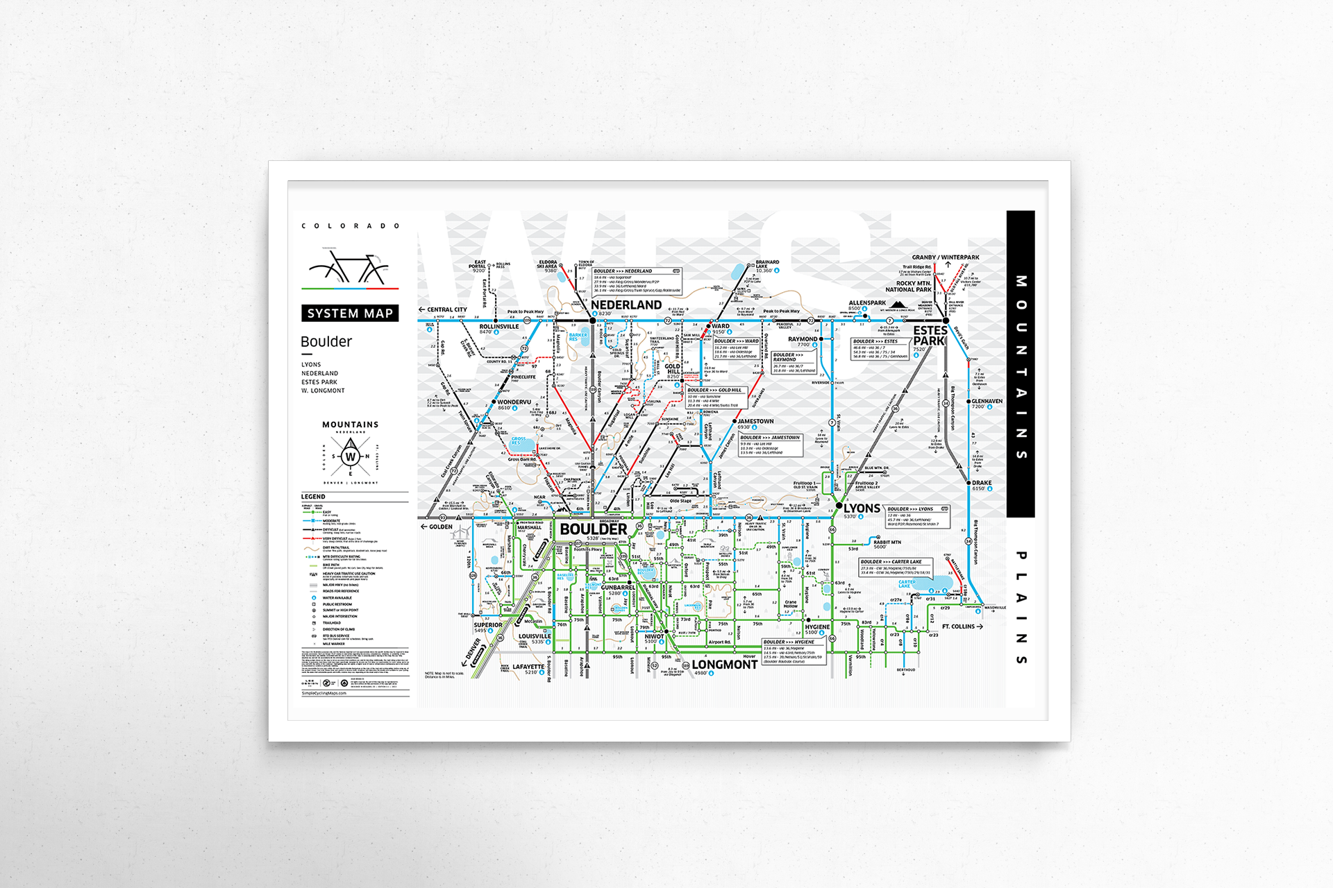
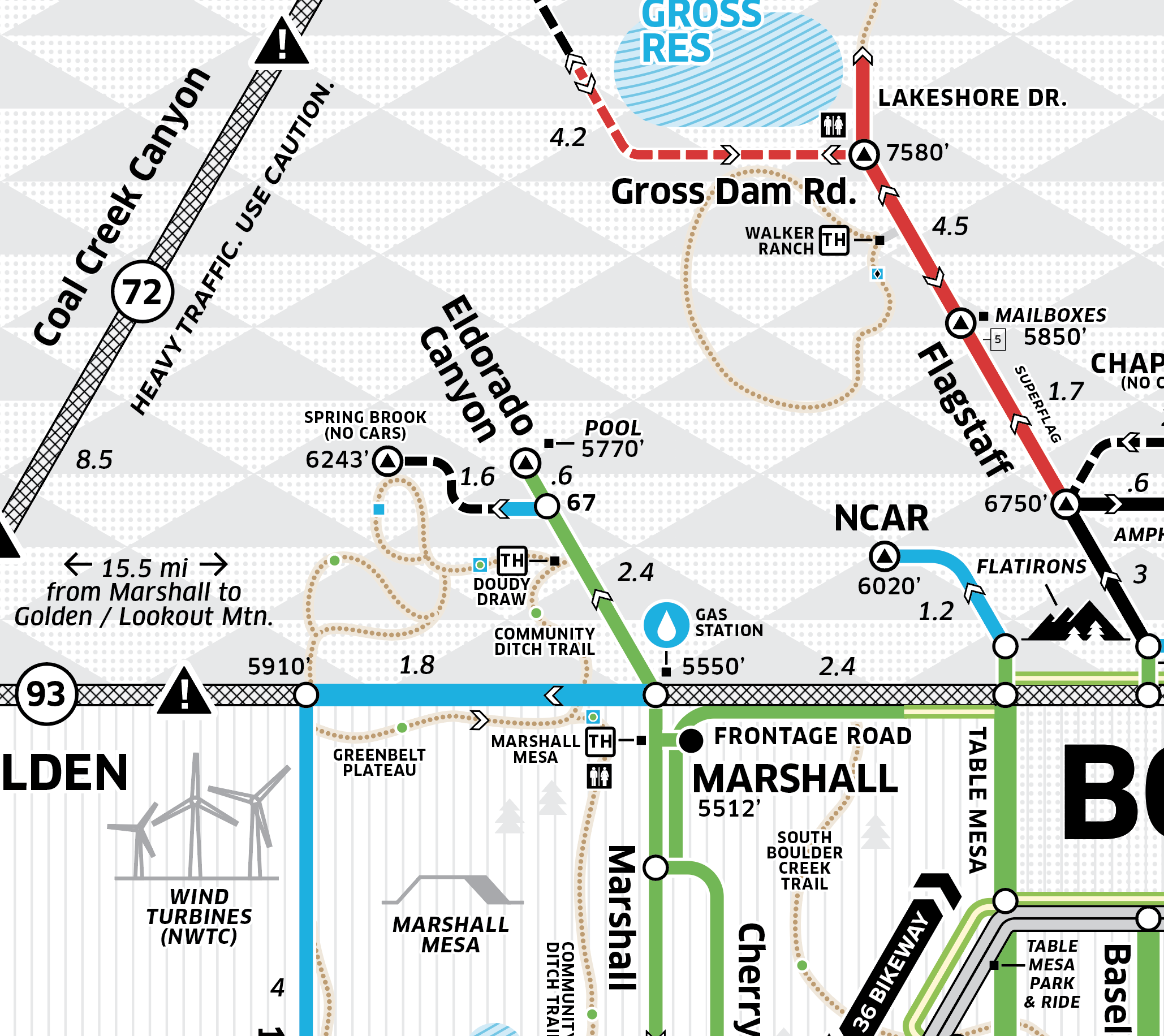
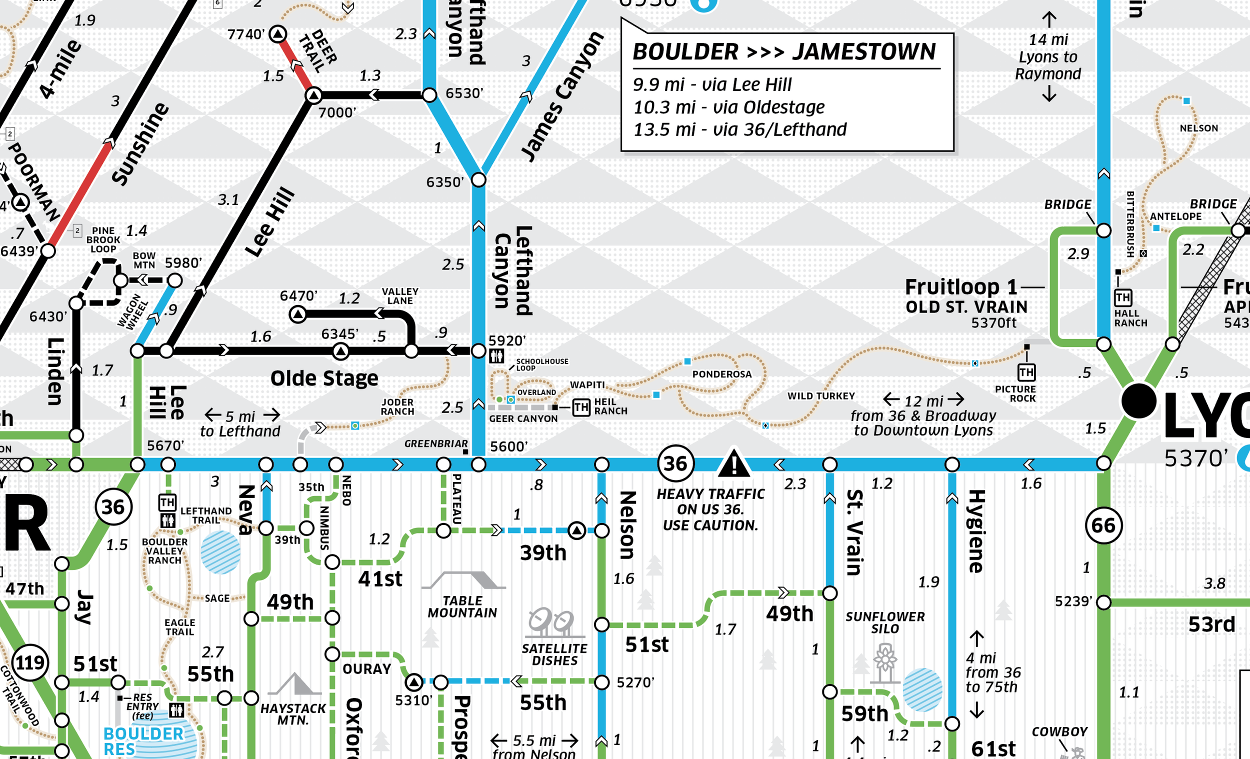
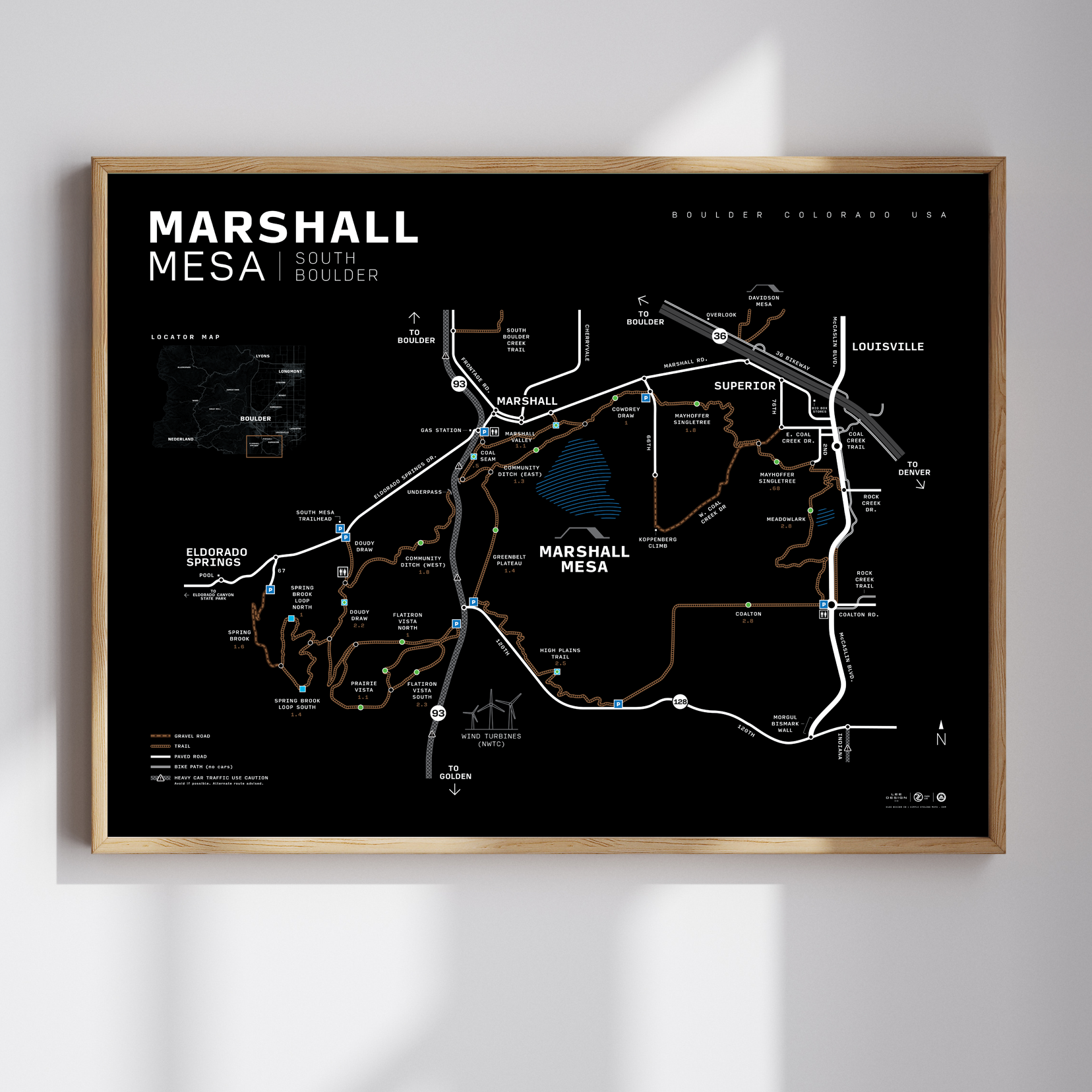
Boulder, CO – City Map Poster
Part subway map, part ski trail map—this oversimplified city diagram reimagines Boulder through the lens of a cyclist.
Our newly updated Boulder City Map features a west-up orientation to reflect the true pull of the mountains. Designed with a bold, minimalist style, it highlights popular road and gravel routes, cut-throughs, key climbs, and essential stops—from Flagstaff and Lee Hill to the Boulder Reservoir and beyond.
What’s on the map:
• Major climbs + cyclist destinations drawn to scale
• Trail difficulty coded by color and surface type
• Road network simplified for clarity, like a transit map
• Updated trail info including Cobalt & North Sky Trails
• Cafes, restrooms, bike shops, and hidden connectors
Printed on high-quality stock and designed in Colorado, this 18x24" poster is equally at home in your garage-mahal, home gym, or office.
Maps are always evolving—and this version reflects our latest updates. Designed by riders, for riders.